Imagine finding an old photograph from a trip, but you can't remember where exactly it was taken. Or you need to find out the location of old friends with only their photos from social networks. These tasks may seem difficult, but modern tools make it easy to solve them. The key is to know where to look for those tools and how to use them.
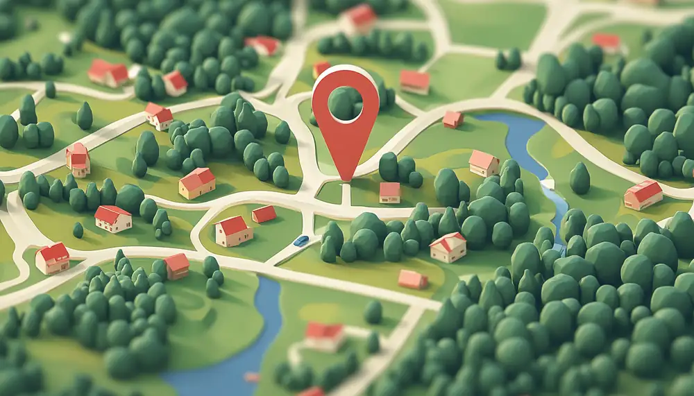
Techniques for determining location from photographs
The process of searching for geolocation from a photo is interesting because there is no universal method.For example, if you took a photo with a modern digital camera or smartphone, you should start your search by analyzing the metadata. Metadata may indicate authorship, technical information about the camera, lens settings, and additional descriptions, including GPS coordinates of the place where the photograph was taken, of course, if a GPS receiver is installed.This information allows viewer programs to visualize the geolocation of the photograph on a map.
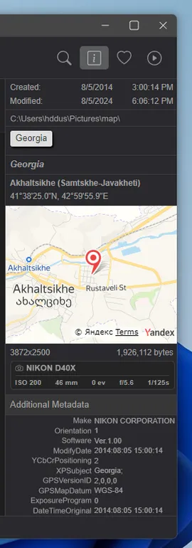
The problem is that GPS coordinates are not always included in the metadata due to device-specific settings or may be intentionally removed. This can be intentionally removed when publishing to protect user privacy. Or, GPS data could not have been there initially, if we are talking about a scan of a paper photograph.
Photo location can be found using several methods:
- The environment of the photograph. The folder as well as neighboring photos can give a lot of information about the origin of the photo. Paper photos often have handwritten notes on the back.
- Search engines. The method is useful for identifying landmarks or well-known historical places. Due to the limited capabilities of search engines they are simply looking for similar images.
- Artificial intelligence (neural networks). Specially trained models search for a place by indirect signs (relief, shape and location of mountains, etc.). However, the neural network algorithm will only give approximate coordinates.
- Manual search. This method is more complex and requires deep geographical knowledge. But it can become a real hobby, as, for example, for browser game players GeoGuessr: They can identify a random road somewhere in the favelas of Brazil in just a few minutes. Below we will talk about these methods in more detail.
How to find a place using a photo's GPS metadata
In the Windows OS, there are two ways to find out a location from a photo: through the file properties or in the Photos program. In the first case, you need to right-click on the photo and select Properties.
In the window that opens, you need to go to the Details tab and find the GPS coordinates of the place in the photo.
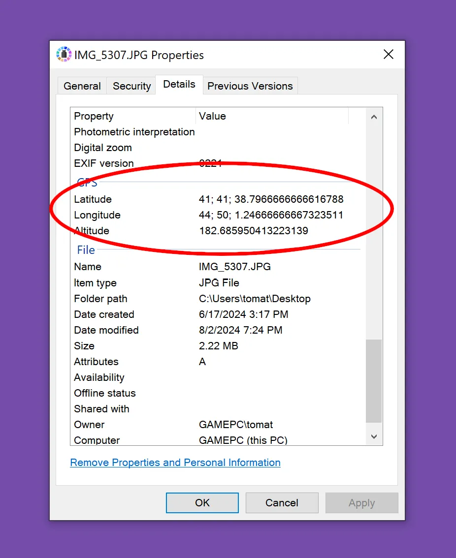
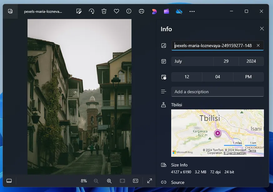
This way you will only see the coordinates, and not the place itself. However, the program immediately creates a visualization on the map of the place where exactly the photo was taken.
Obviously, there are third-party programs for determining the location in a photo by reading metadata, for example, Tonfotos, which is completely free. The advantage of the program is that it can show the location of all the images stored in the computer’s memory.
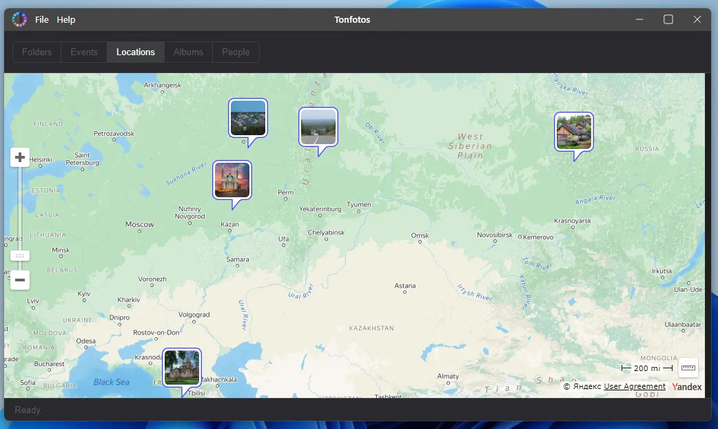
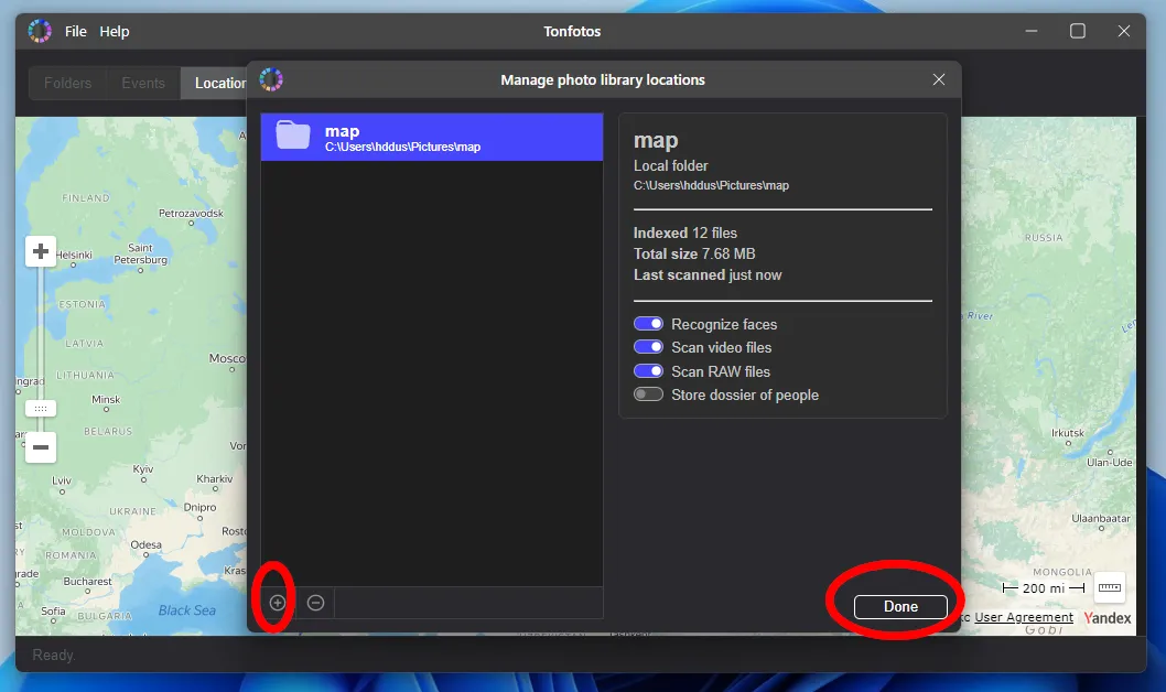
First you need to add the corresponding directory to the Tonfotos database. Once you've finished indexing all the contents in the folder, you'll be able to view your travel history right on the map.
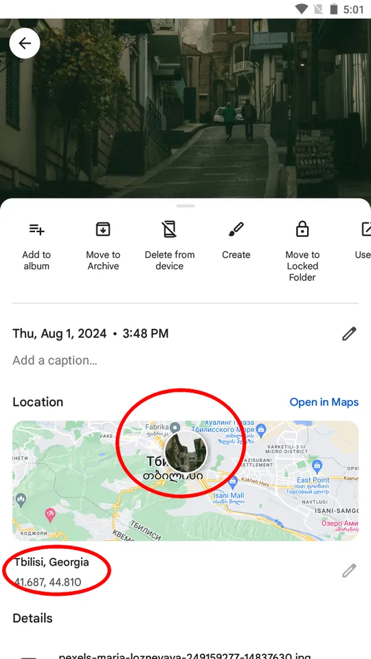
You can find a place in a photo using a GPS tag not only on a computer, but also using a smartphone without the need to download additional applications. Google Photos or Apple Photos will suffice, depending on which phone you use: iPhone or Android.
To see the location on the taken photo in Google Photos, you need to open the photo and swipe from bottom to top. In a context menu, you will see the coordinates and visualization of the place with the photo on the map.
How to Find a Place in a Photo in Google Lens
The Google search engine is a powerful tool when you need to find the information you need, and it is not only about the text, but images as well. Google Chrome users can use the Lens tool directly from the browser's home page. In all other cases, you will need to first go to the search engine website google.com.

You add a photo through the dialog box, and after a few seconds the search engine will offer several similar photos from the Internet, where you can understand the location of the place based on the descriptions.
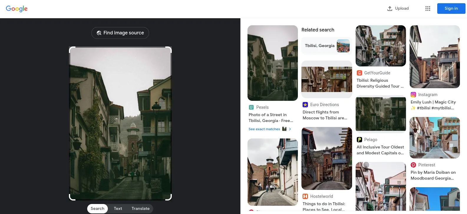
For a more accurate search, simply change the selection area.
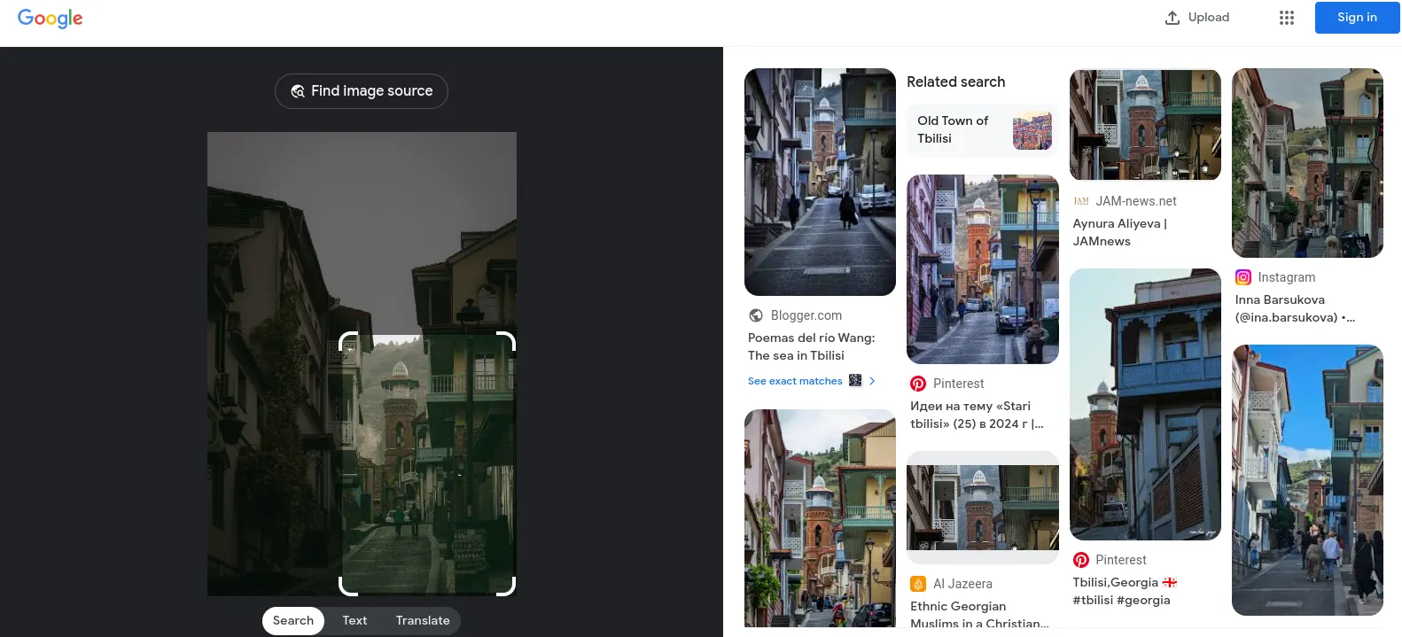
It works the same way in the Google application on your mobile phone.
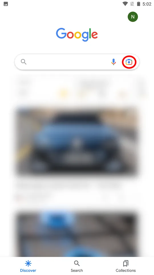
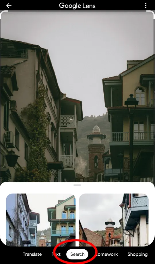
However, after uploading the image, you need to make sure that search is selected as the application operating mode.
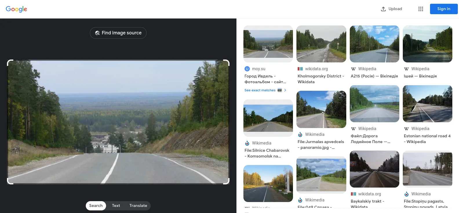
Search engines can help you find the location of famous landmarks, but they are not really good for less significant objects like roads or landscapes.
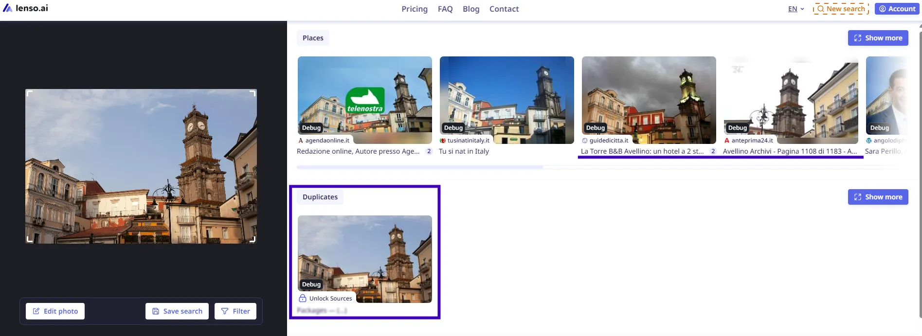
Actually, there are alternatives to Google Lens for reverse image search, such as lenso.ai. You will be able to check the Places category, which provides plenty of results related to the specific place you are looking for. Moreover, you can find an exact duplicate of the image, bringing you even closer to identifying the location in the photo.
How to find a place in a photo using the Geolocation Estimation neural network
Geolocation Estimation is an open-source AI model that analyzes a photo to estimate its location, based on indirect markers like architecture, soil color, sun position. The result of this neural network is not photographs, but approximate coordinates.
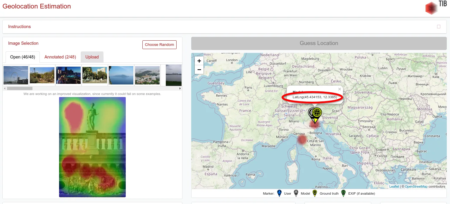
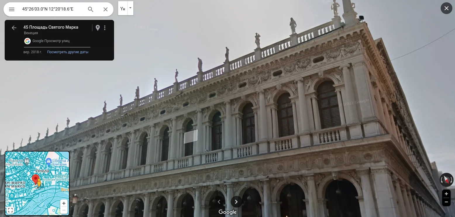
By copying this information and pasting it into the Yandex.Maps or Google Maps search, you will find the geolocation, and using the Street View tool you will find a specific one. For example, the photo you see below was taken in St. Mark's Square in Venice.
Manual method for determining geolocation from a photo
To establish the place where a photograph was taken, it helps to have some knowledge about the geography and culture of different territories. As a source of inspiration, you can watch videos and guides that GeoGuessr players publish on the Internet. Of course, not all of them are relevant, since photography is not Google Street View, which the game is based on, but you can still find some good ideas..
Here are some of the most common signs that, according to these guides, allow you to make your search easier:
- The driving side of the car. Pay attention to which side of the road the cars are on. If on the left, the photo shows one of 75 countries in the world.
- Shape and color of car license plates. Even if the cars are too far away and you cannot see the specific meaning of the number, you can determine the country by its shape and color. For example, in Portugal, plates of the pan-European standard are used, but they have a difference in the form of a yellow stripe on the right side.
- Street inscriptions. The inscriptions on billboards or store signs will help find out the language of the country in the photo.
- Domain on posters. Companies and cafes publish their websites so that visitors can arrange delivery or get acquainted with their activities. At the end there is always a domain zone that corresponds to the abbreviation of a particular country.
- Road signs. This could be a highway number, the name of the nearest town. In addition, some locations may have specific signs. For example, in some countries the road sign for repair work is orange, while in others it is yellow.
Let's look at examples of photographs where we can use the content to determine the approximate location.
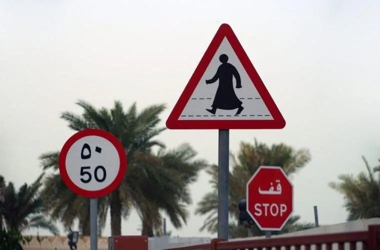
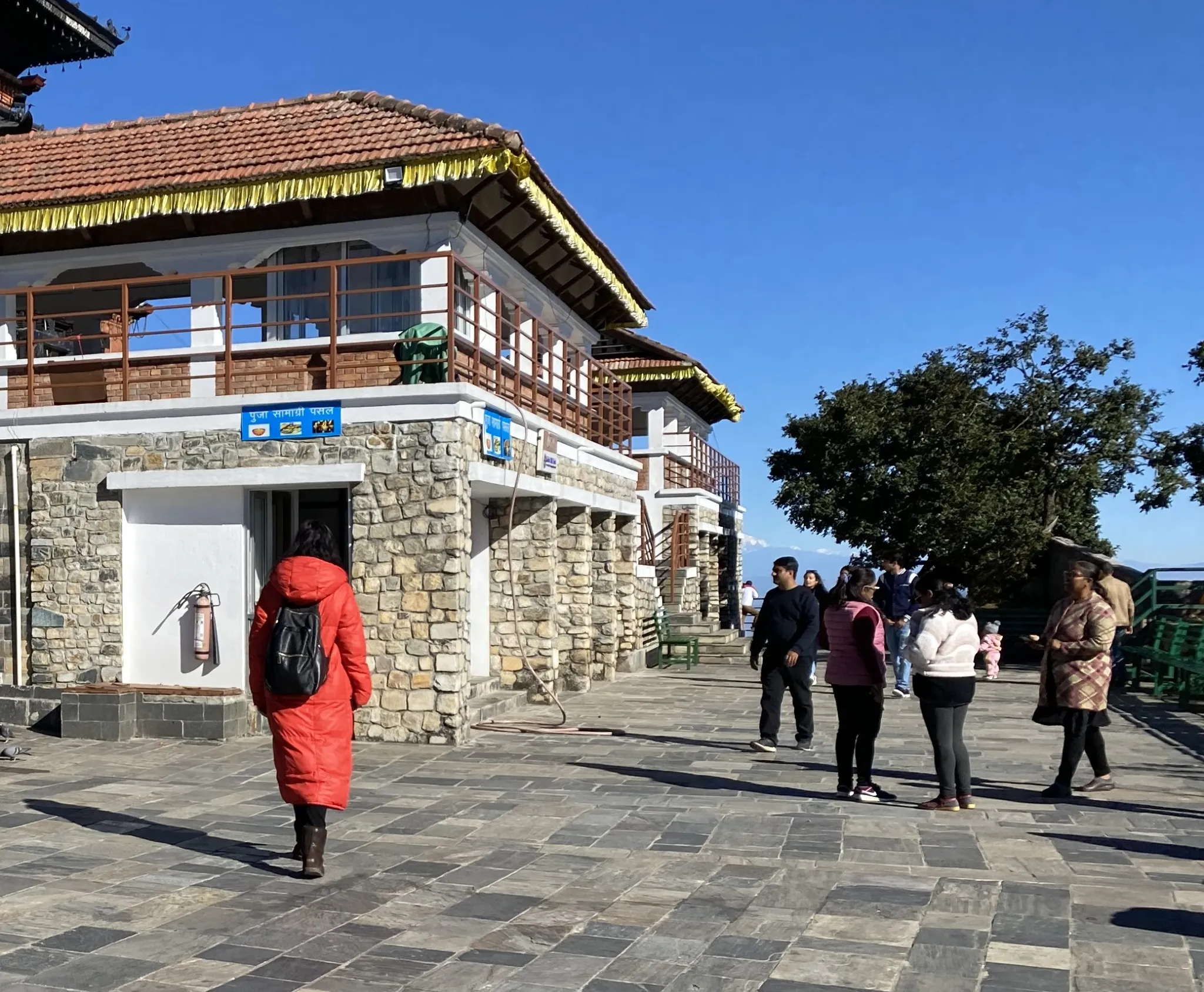

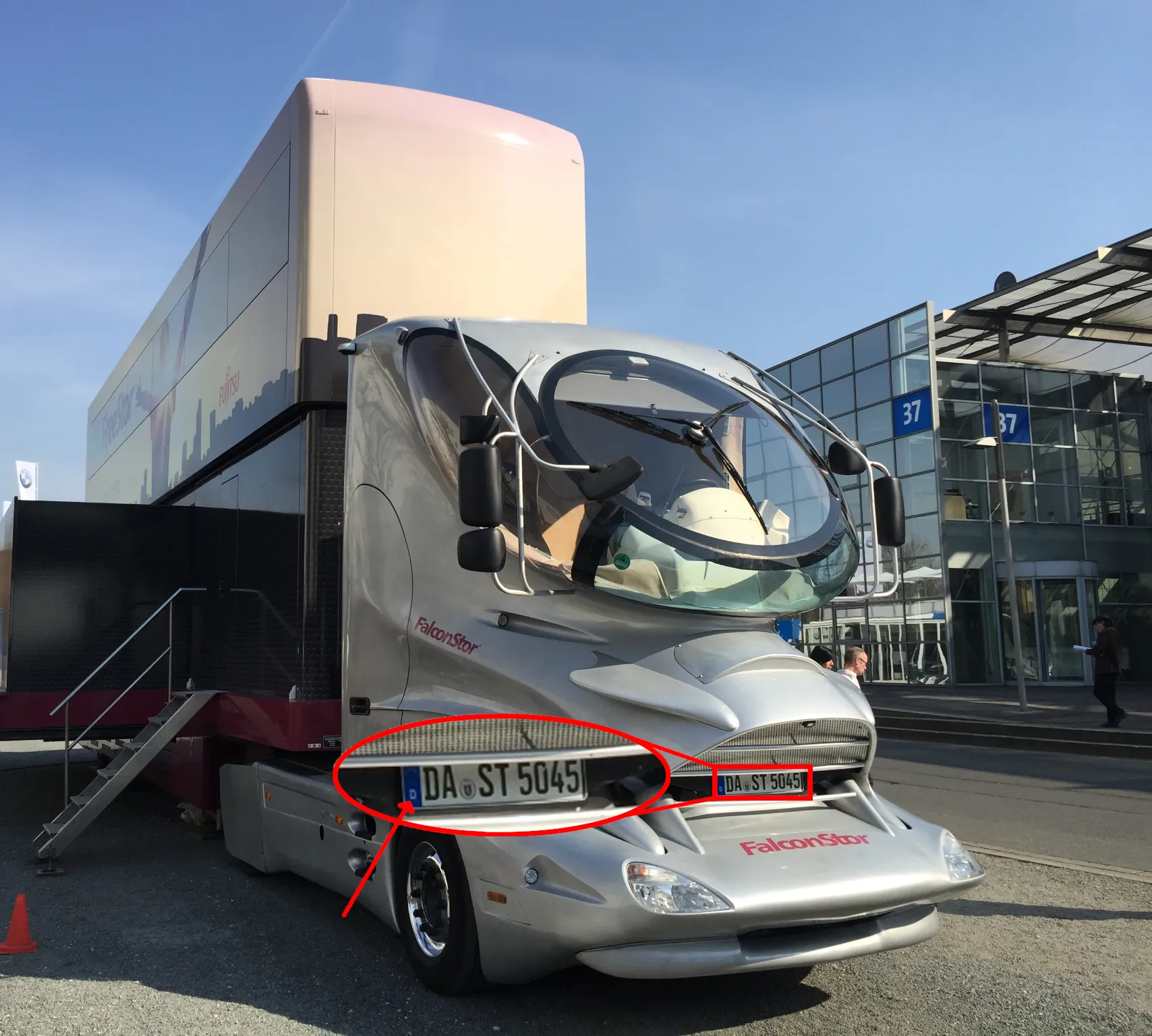

If it is difficult for you to find out the location usings indirect signs, then you can ask the communities of GeoGuessr players for help. For example, on Reddit there are such groups https://www.reddit.com/r/geoguessr/ or https://www.reddit.com/r/geoguessing .
Conclusion
Modern technologies have made significant progress in determining location from photos, especially thanks to AI. Now finding a place has become much easier due to many effective tools and services. From reading metadata to using powerful neural network algorithms, users have a wide range of methods to find the locations in images, and that opens up new possibilities for exploring and reconstructing memories.